The Fraser River' s Edge Lodge
- The Fraser River' s Edge Lodge
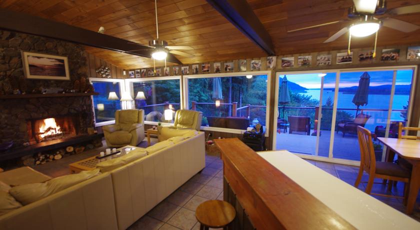
The Fraser River' s Edge Lodge (Чилливак,Канада)
     |
| Категория отеля: | 4-звездочный отель |
| Адрес: | 43037 Old Orchard Road, V2R 4A6 Чилливак, Канада |
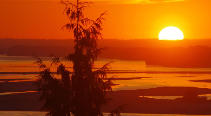
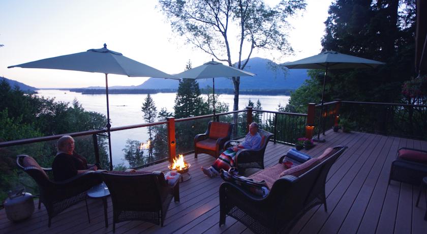
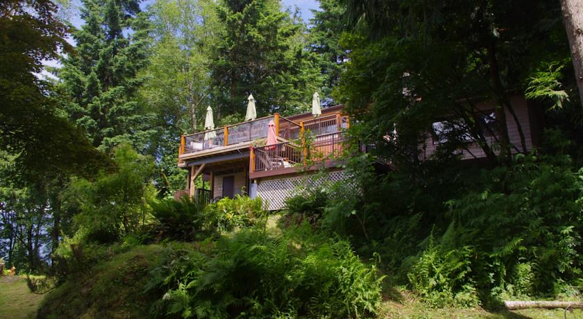
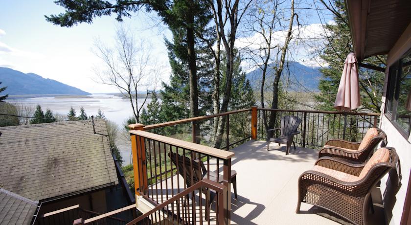
| Описание: | Less than 5 minutes walk from the Fraser River, this property boasts a waterfront location with mountain views. Free Wi-Fi is provided. All rooms enjoy private entrances.A flat-screen cable TV and an iPod docking station are featured in each room at The Fraser River s Edge Lodge. River views can be enjoyed from every air-conditioned room. A private deck is offered in all rooms.Shared kitchen facilities are provided for guest use at The Fraser River s Edge Chilliwack. A BBQ, outdoor seating and a hot tub are also provided. Breakfast is available at an additional charge. Salmon and sturgeon fishing are also available from this property.Chilliwack is 8 km from this property. Cultus Lake 23 minutes drive away. |
| Еда и питье: | |
| На свежем воздухе: | Барбекю , Терраса |
| Парковка: | Бесплатно! Бесплатная Частная парковка на месте (предварительный заказ не требуется) . |
| Услуги: | Номера для некурящих, Отопление, Кондиционер, Места для курения |
| Спорт и отдых: | Рыбная ловля, Гидромассажная ванна, Библиотека |
| Сервис: | Упакованные ланчи, Общий лаунж/гостиная с телевизором |
| Интернет: | Бесплатно! Wi-Fi предоставляется на территории всего отеля бесплатно. |
| Языки общения: | |
| Время заезда/выезда: | 16:00 - 21:00 / До 11:00 |
| Домашние животные: | Размещение домашних животных допускается по предварительному запросу. Данная услуга может быть платной. |
| Банковские карты: | visa,euromastercard, |
| Номерной фонд: | Отель типа "постель и завтрак": 3 номера |
| Координаты: | ш. 49.155921431048974 д. -122.03861072670406 на карте |
| | |
Каталог отелей.
Полезное
Смотреть что такое "The Fraser River' s Edge Lodge" в других словарях:
Columbia River — Coordinates: 46°14′39″N 124°3′29″W / 46.24417°N 124.05806°W / 46.24417; 124.05806 … Wikipedia
Battle of the Little Bighorn — Coordinates: 45°33′54″N 107°25′44″W / 45.565°N 107.42889°W / 45.565; 107.42889 … Wikipedia
Mount Fraser (Canada) — Mount Fraser … Wikipedia
Close To The Edge Provincial Park and Protected Area — is a provincial park and a protected area in British Columbia, Canada. Contents 1 History and conservation 2 Location 3 Size 4 … Wikipedia
native American — native American, adj. a person born in the United States. [1835 45, Amer.] * * * ▪ indigenous peoples of Canada and United States Introduction also called American Indian, Amerindian, Amerind, Indian, Aboriginal American, or First Nation… … Universalium
Native American — Indian (def. 1). Usage. See Indian, Eskimo. * * * ▪ indigenous peoples of Canada and United States Introduction also called American Indian, Amerindian, Amerind, Indian, Aboriginal A … Universalium
railroad — /rayl rohd /, n. 1. a permanent road laid with rails, commonly in one or more pairs of continuous lines forming a track or tracks, on which locomotives and cars are run for the transportation of passengers, freight, and mail. 2. an entire system… … Universalium
Boston Bar, British Columbia — Boston Bar is an unincorporated town in the Fraser Canyon of the Canadian province of British Columbia. It was not named for an organization of Massachusetts lawyers but dates from the time of the Fraser Canyon Gold Rush (1858 1861). A bar is a… … Wikipedia
Monkman Pass — Monkman Pass, 1061 m (3481 ft),[1] is a mountain pass in the Canadian Rockies, located southwest of the coal mining town of Tumbler Ridge, British Columbia. Located in the Hart Ranges, it is sometimes reckoned as the southern limit of… … Wikipedia
Mount Kain — Mount Kain … Wikipedia